Put a sentry on the water. Put your name on the map.
Fund a complete flood sensor station — solar-powered hardware, professional installation, and three full years of connectivity and maintenance — deployed at a surveyed high-need site and carrying your name on the public live map.
One station, end to end — $3,200 (≈ GHS 52,000) all-in
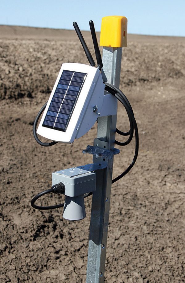
Sensing
Radar or ultrasonic water-level sensor, rain gauge, temperature & humidity, and atmospheric-pressure sensors in a flood-rated IP67 enclosure.
Power
Solar power with battery backup — 5+ days of autonomy even with no sun, reporting every 60–120 seconds.
Connectivity
LoRaWAN or LTE-M/Cat-M1 communications with GPS location, plus 3 years of data/SIM costs — connected when it matters most.
Security & care
Tamper detection, an optional AI camera for visual flood confirmation, professional installation, a trained local warden and 3 years of maintenance.
Planned sites looking for a sponsor
These sites are surveyed and waiting for a gauge. They are not on the live map until the gauge reports. Fund one and your name goes on it.
Lapaz / Abeka
Abeka drain, N1 interchange · Medium · ETA Sep 2026
High-impact site
Fund this siteMakola / Rawlings Park
Central Business District drain · Professional · ETA Q1 2027
High-impact site
Fund this siteWeija Dam Downstream
Densu River spillway · Professional · ETA 2027
High-impact site
Fund this siteNima / Paloma
Nima drain, Kanda Highway · Medium · ETA Q4 2026
High-impact site
Fund this siteKwame Nkrumah Circle
Odaw River, Circle Interchange · Professional
High-impact site
Fund this siteKorle Lagoon Outfall
Odaw estuary, Korle Gonno · Medium · ETA Aug 2026
High-impact site
Fund this siteThree ways to deploy
Station Guardian
Co-fund a station with nine other guardians.
- Name listed on the station's map page
- Deployment photos & updates
- Quarterly impact report
Station Sponsor
Fund one entire station at a priority site.
- Your name/brand on the station & live map
- Choose from surveyed high-impact sites
- 3 years connectivity & maintenance included
- Deployment ceremony & media kit
Basin Partner
For corporates, DFIs and agencies protecting a whole corridor.
- Cluster deployment (5+ stations)
- Branded risk dashboard & API access
- Board-level impact reporting
Complete your station funding
Selected: Station Sponsor (full station) — GHS 52,000
Processed by Paystack (card, mobile money, bank transfer). For USD payment or invoicing, email [email protected]. International donors can also give via GoFundMe ↗.
From payment to live data in ~8 weeks
We match your station to the highest-need surveyed site (or you pick from the planned sites on the map).
Node assembled and tested; site permits secured with the Assembly; local warden recruited.
Field team installs and calibrates the station; you receive deployment photos and coordinates.
Your station starts streaming data on the public map with your name on its detail panel.
Not ready for a full station?
Every cedi still buys minutes of warning for someone in the flood path.